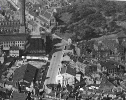
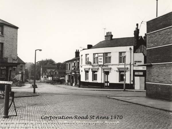
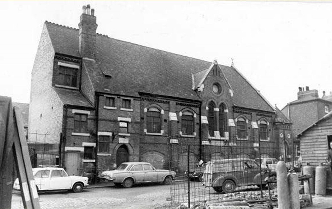
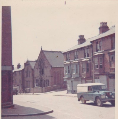
ST ANN'S WELL ROAD PRE DEMOLITION (1970)
CHURCHES
INDEX
....click on the links below for specific churches:
Catholic Apostolic Church, Northumberland St
Christ Church, Peas Hill Road
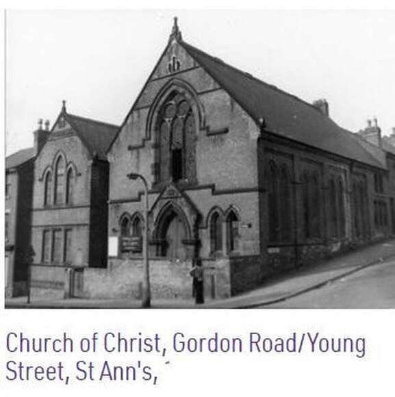
Church of Christ Gordon Road
Congregational Church, St Ann's Well Road
Holy Trinity
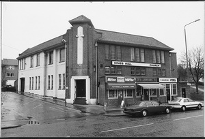
King's Hall Methodist, St Ann's Well Road
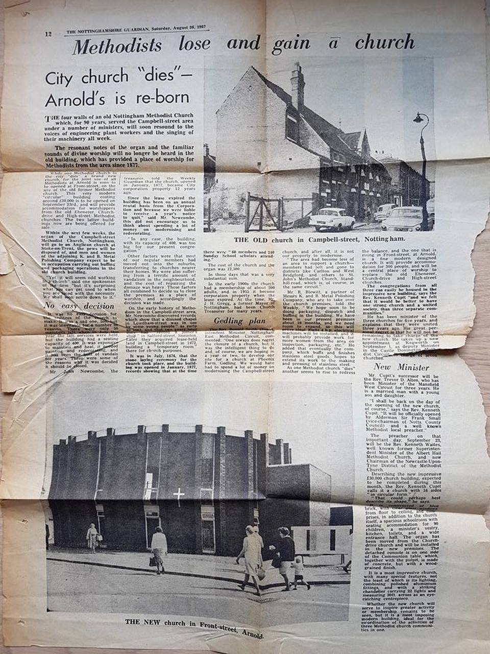
Methodist Chapel, Campbell St
Our Lady & St Edward
Salvation Army
St Andrews
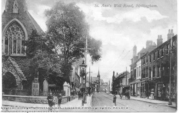
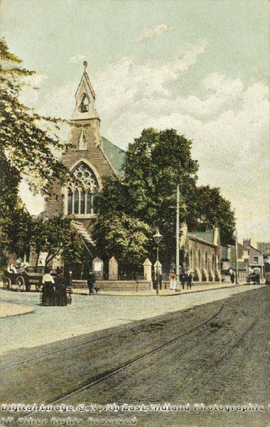
St Ann's, St Ann's Well Road
St Augustine
St Bartholomews, Gordon Road
St Catherines
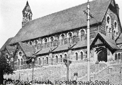
St Emmanuels
St Marks
St Mathias
St Pauls
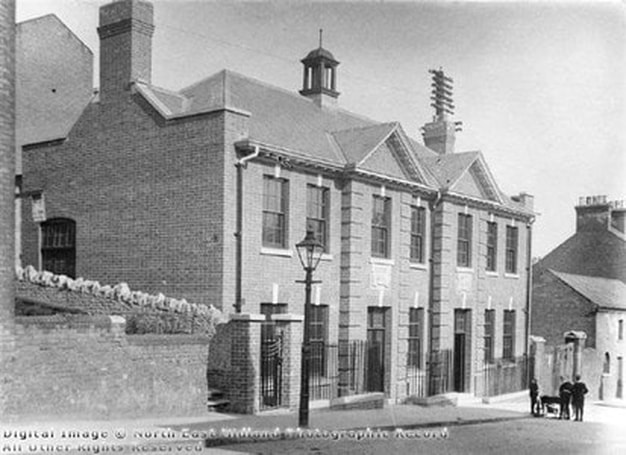
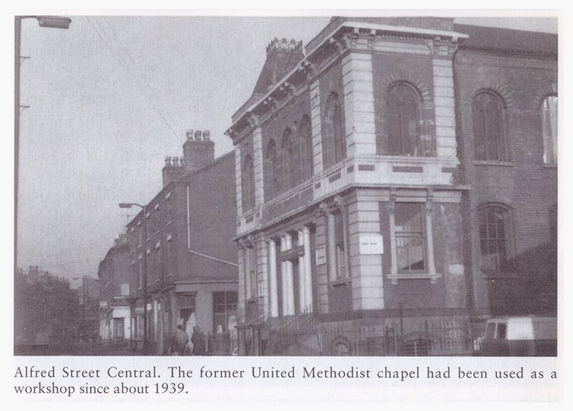
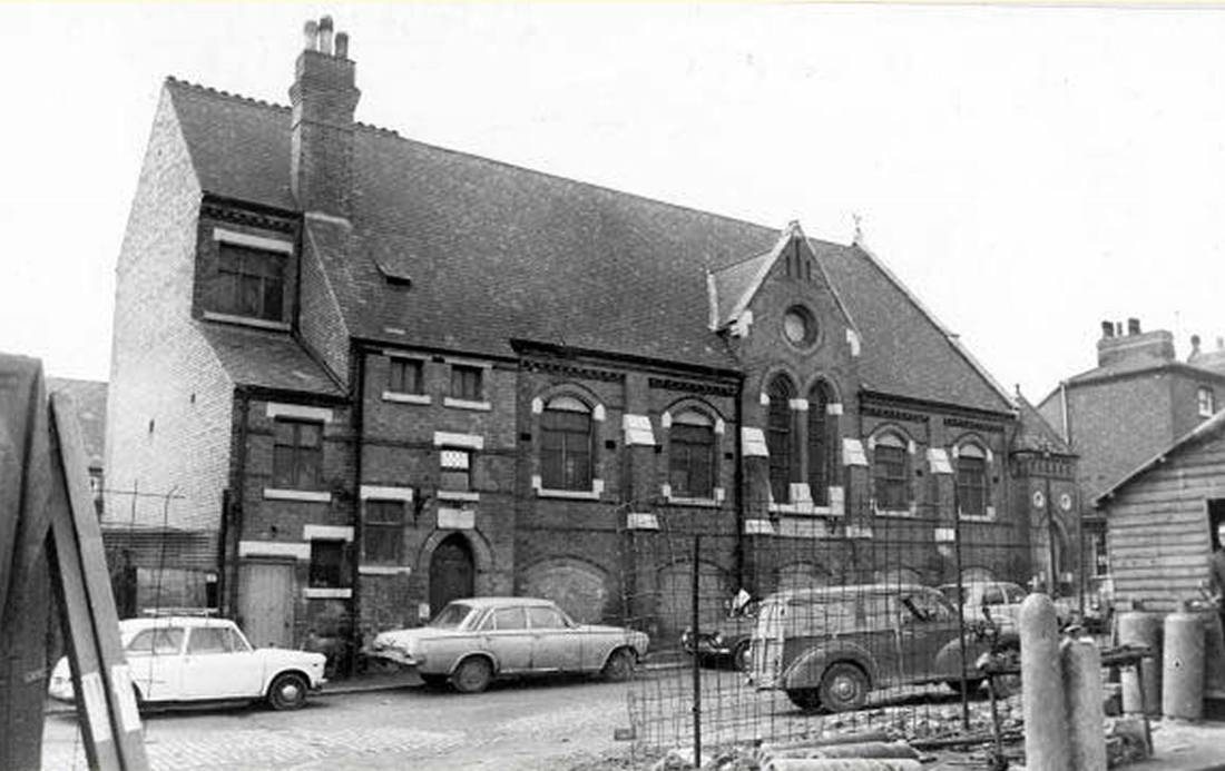
United Methodist Chapel, Alfred St Central
Churches - Facebook Photo Album
....click on the links below for specific churches:
Catholic Apostolic Church, Northumberland St
Christ Church, Peas Hill Road
Church of Christ Gordon Road
Congregational Church, St Ann's Well Road
Holy Trinity
King's Hall Methodist, St Ann's Well Road
Methodist Chapel, Campbell St
Our Lady & St Edward
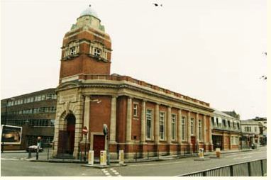
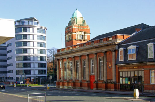
Salvation Army
St Andrews
St Ann's, St Ann's Well Road
St Augustine
St Bartholomews, Gordon Road
St Catherines
St Emmanuels
St Marks
St Mathias
St Pauls
United Methodist Chapel, Alfred St Central
Churches - Facebook Photo Album
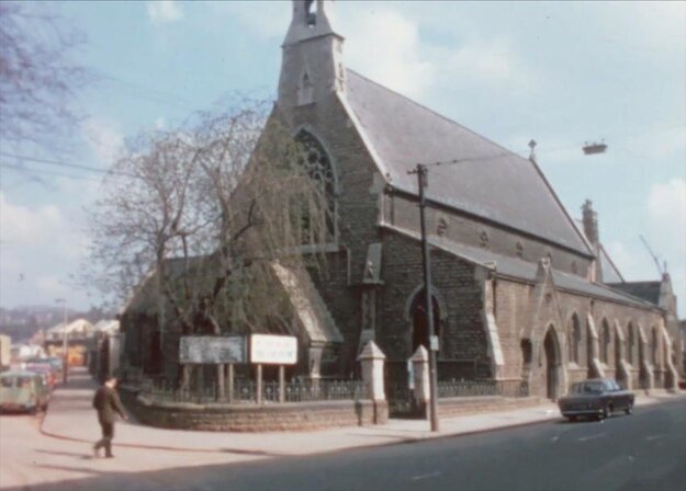
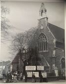
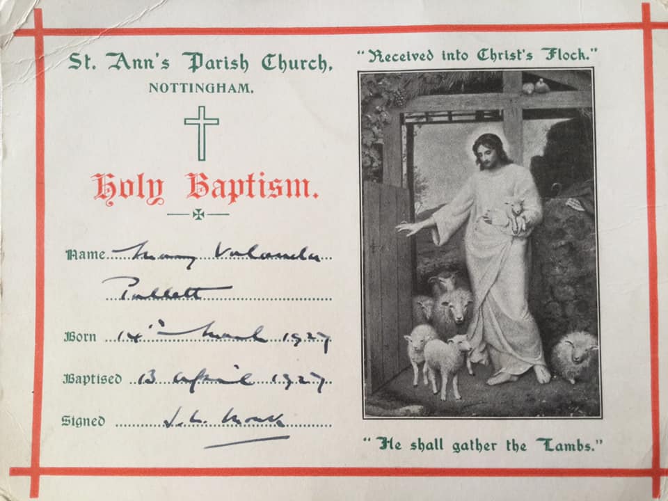
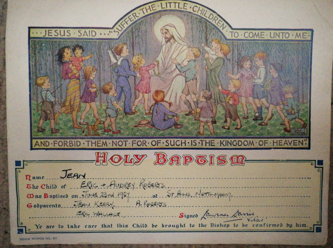
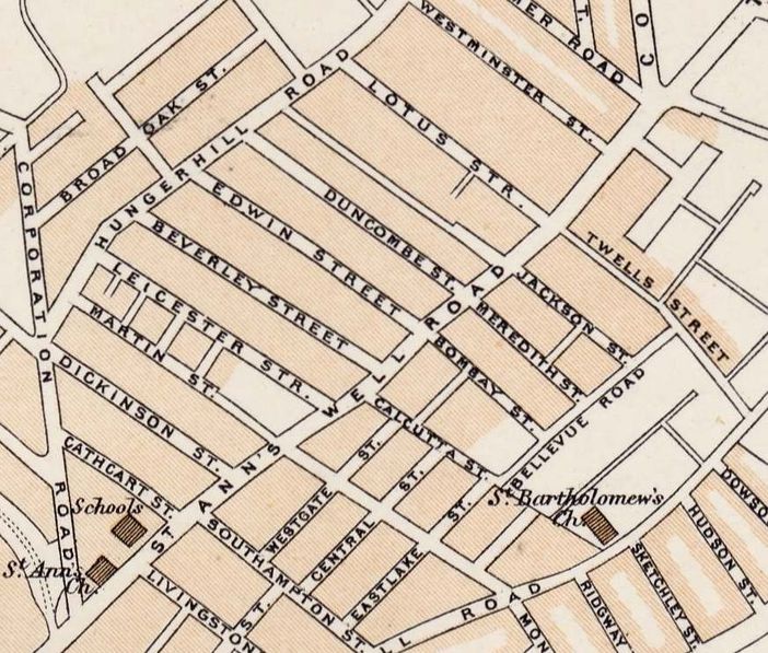
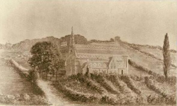
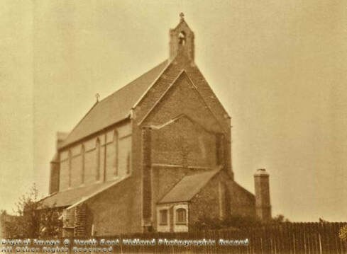
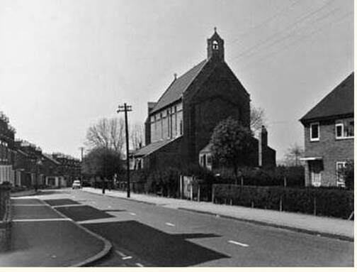
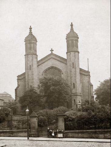
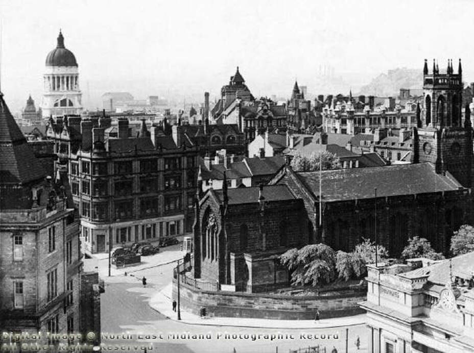
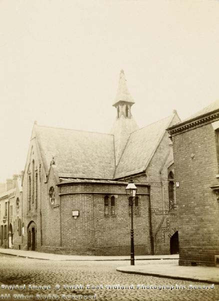
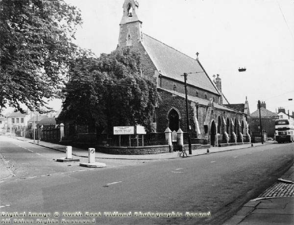
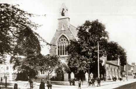
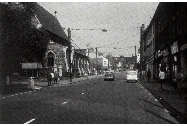
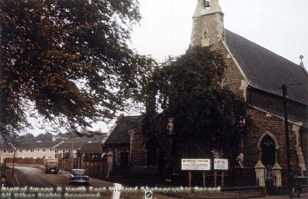
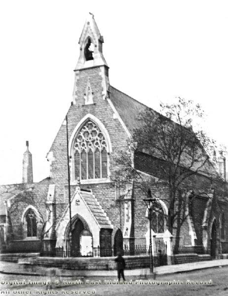
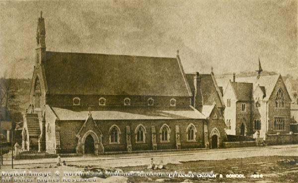
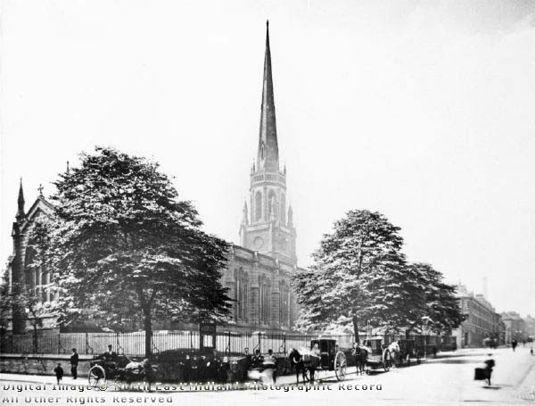
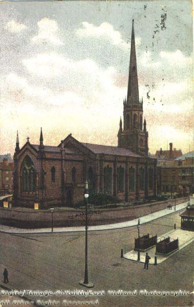
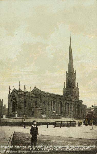
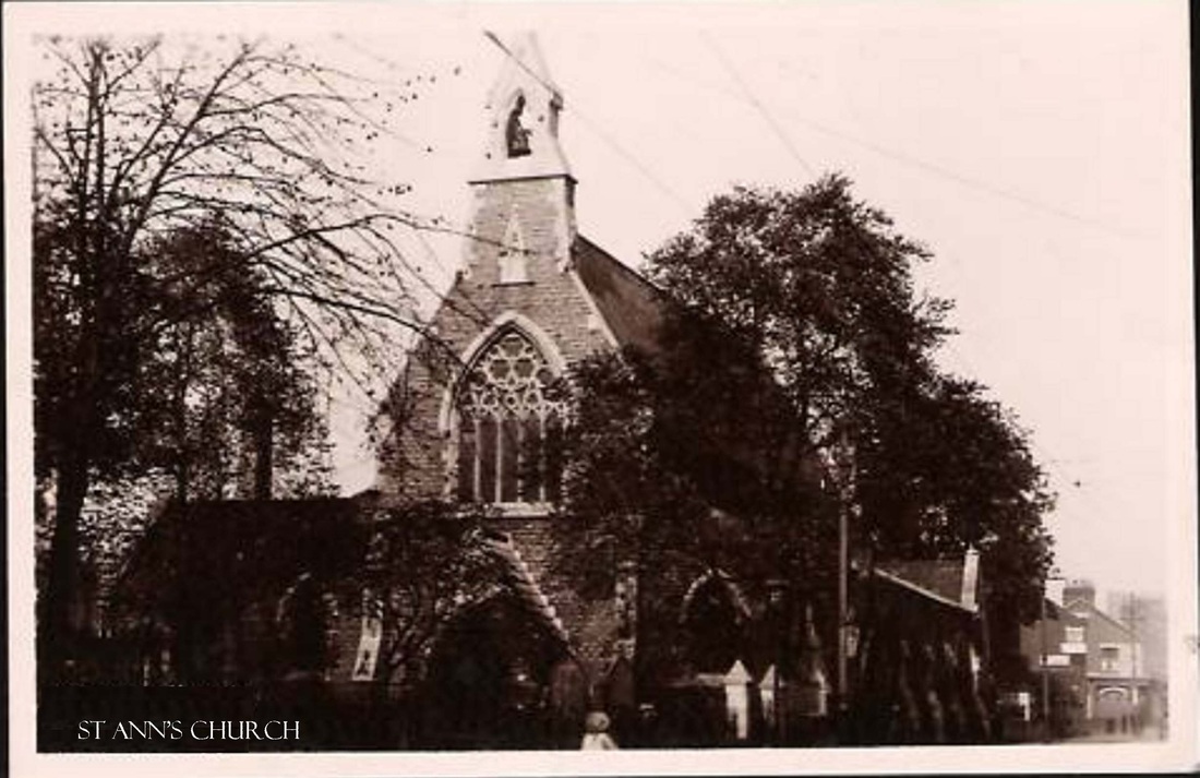
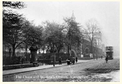
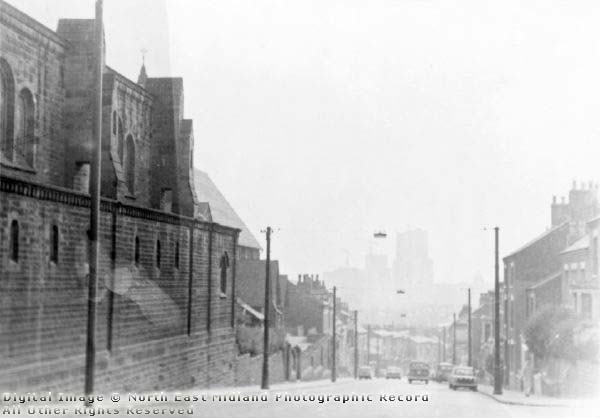
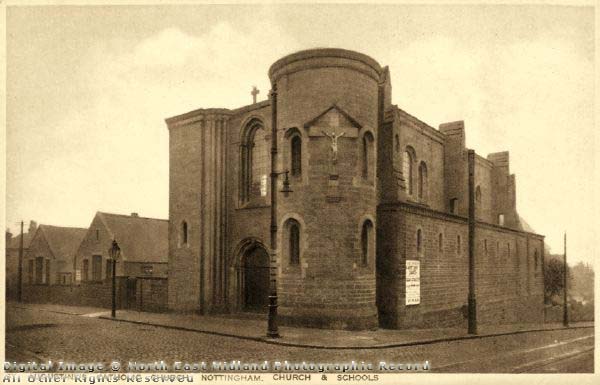
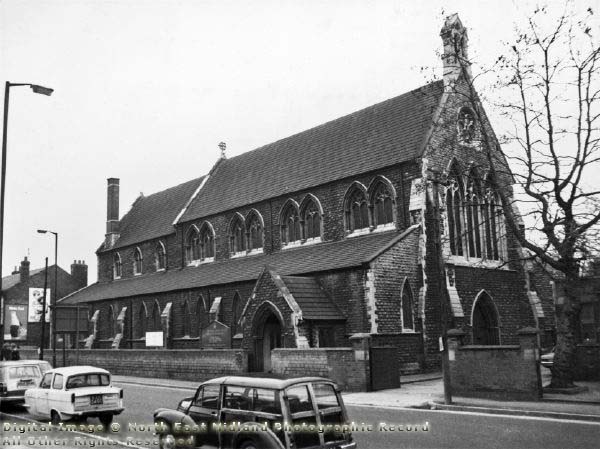
St Anns Church was located at the junction of St Anns Well Rd, Corporation Road and the Robin Hood Chase.
The church was demolished in 1971.
The pews went to St Augustine’s Church, Mansfield,
four stained glass windows to St Mary’s Clifton,
communion rails to Kegworth St Andrew,
the oak vestry screen to Hucknall
and the brass lectern to Orston.
LINK HERE TO SOUTHWELL & NOTTINGHAM CHURCH HISTORY PROJECT
for more about St Anns Church
On the evening of Easter Sunday 1971 the final service was held. Immediately afterwards a few male members of the congregation set about dismantling and removing the organ, a task they completed late on Easter Monday evening. Unfortunately we have no information as to where, or whether, the organ was installed elsewhere. Demolition commenced at 8 a.m. the next day. Several items removed from St. Ann’s now reside in other local churches, and the east window is now in the USA; sadly other items were left to the fate of the demolishers’ hammers or the scrapyard.
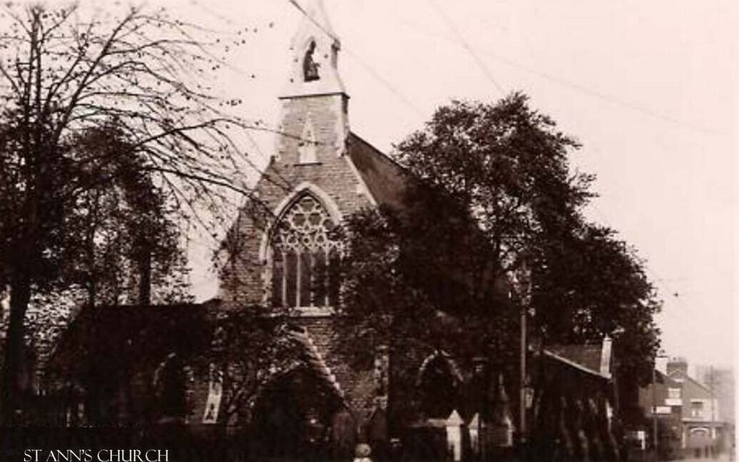
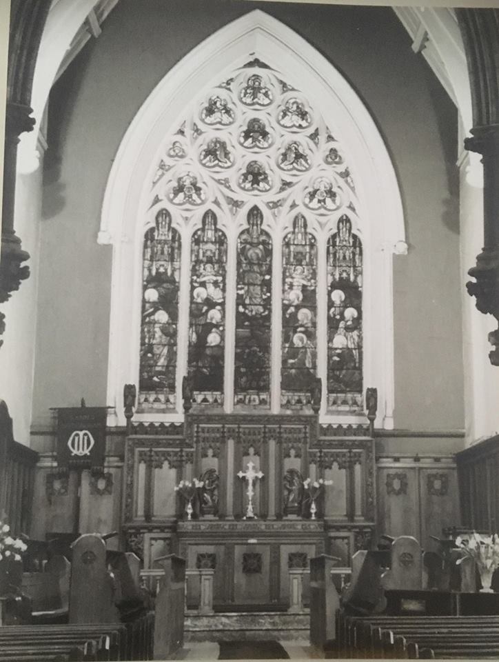
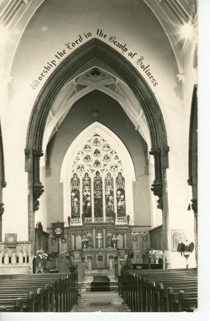
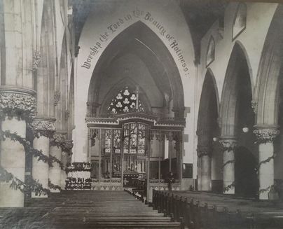
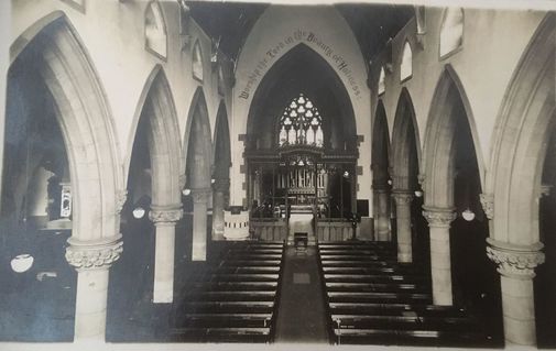
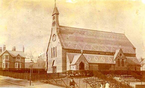
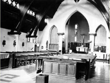
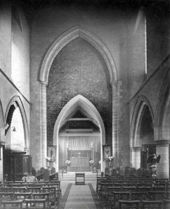
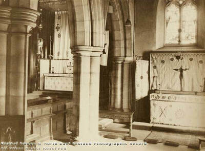
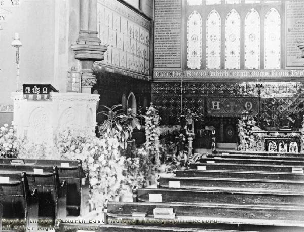
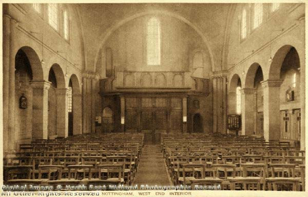
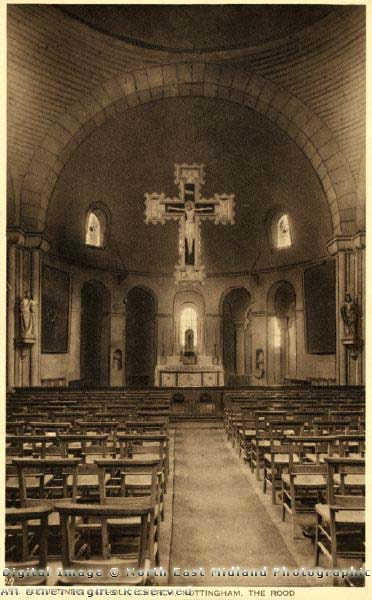
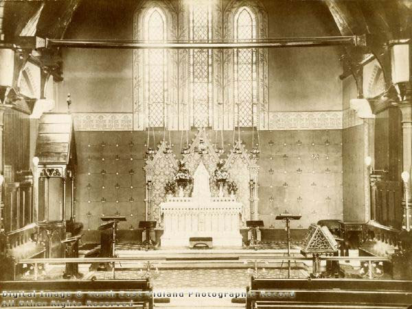
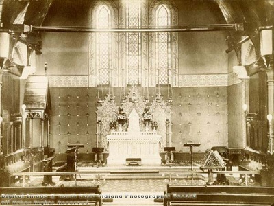
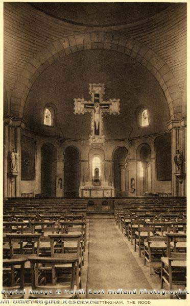
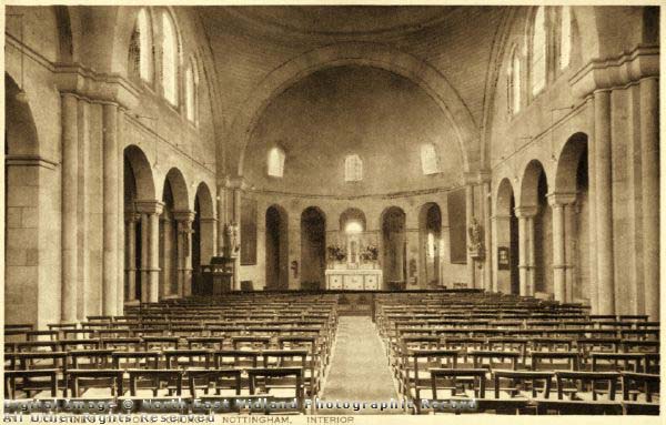
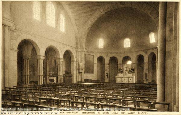
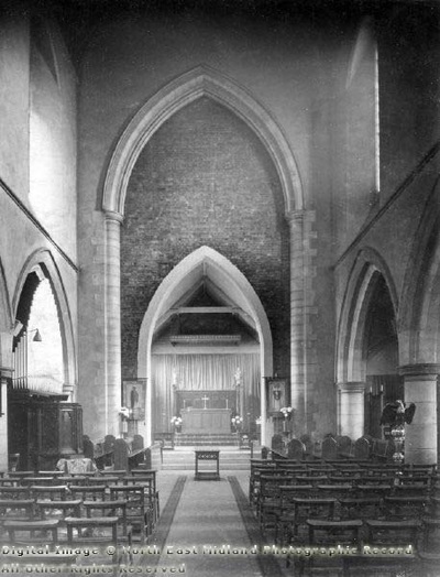
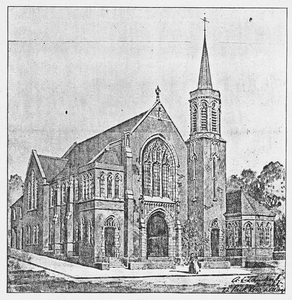
The foundation stone was laid 23 September 1863 by Sydney Pierrepont, 3rd Earl Manvers. The aisles and clerestory had traceried windows, no two alike. The five-light east window showing the Ascension and eleven apostles was made by A D Hemming of London. A memorial window for Henry Shaw was added in 1899. Each side of the east window were the Ten Commandments. Along the front of the chancel arch was the motto ‘Hallelujah for the Lord God Omnipotent Reigneth’.
There was a very elaborate circular pulpit with granite columns, carved capitals and traceried arches.
Closure and demolition took place in 1971
Date of consecration: 26 September 1864.
The church was within the parish of St Mary's Church. The trustees of the new church were Thomas Adams, lace manufacturer, Frances Butcher Gill, a philanthropic silk merchant, Robert Holden of Nuthall, Revd. Edmund Holland of Saxmundham, Revd. Charles Bridges.
The edifice was of Bulwell stone in the Decorated style, consisting of chancel, nave, aisles, transepts, south porch and western bell turret containing one bell.
In 1897 marble steps were laid to the sanctuary, chancel and pulpit and a marble floor to the chancel. There were Minton tiles in the sanctuary. There were carved leaf capitals on the nave pillars, moulded vaulting shafts supported by carved angels in the chancel. The aisles and clerestory had traceried windows, no two alike. The five-light east window showing the Ascension and eleven apostles was made by A D Hemming of London. A memorial window for Henry Shaw was added in 1899. Each side of the east window were the Ten Commandments. Along the front of the chancel arch was the motto ‘Hallelujah for the Lord God Omnipotent Reigneth’.
There was a very elaborate circular pulpit with granite columns, carved capitals and traceried arches.
Closure and demolition took place in 1971
Source of information: southwellchurches.nottingham.ac.uk/nottingham-st-ann/hintro.php
For more information: southwellchurches.nottingham.ac.uk/nottingham-st-ann/hhistory.php
|
|
|
|
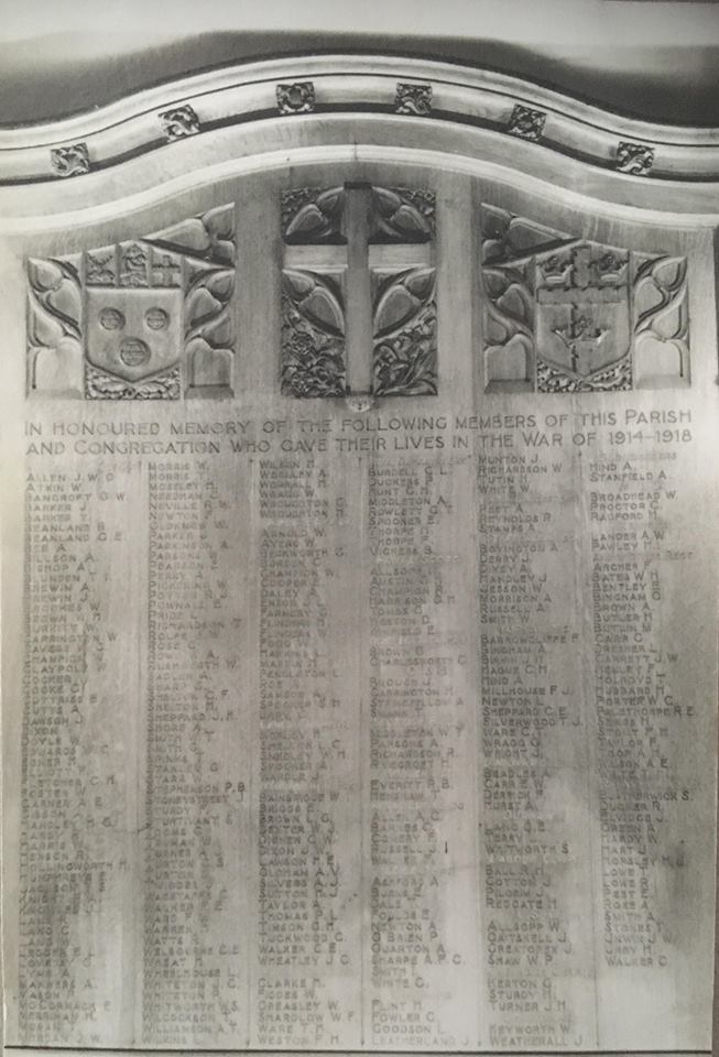
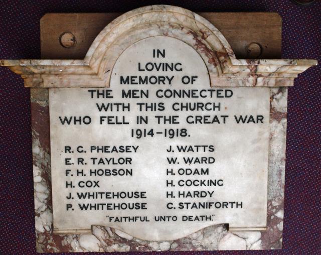
The fate of the WW1 memorial plaque:
Click here for details
Click here for details
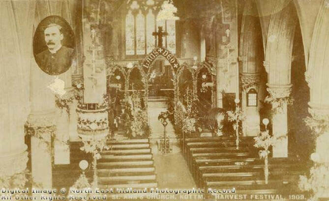
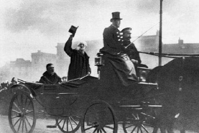
Harvest Festival 1909
Estimated date: Easter 1971
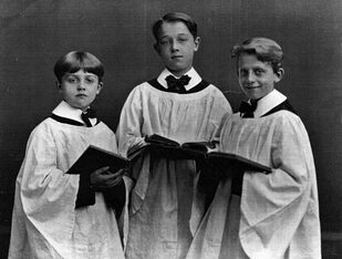
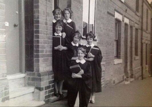
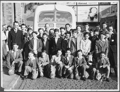
St Ann's Church Choirs
Uncles Ivor, Ron and Fred, St. Ann's church choir, early 30s. (Steve Bloomer)
|
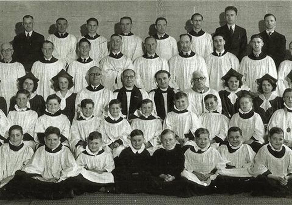
St. Ann's Choir circa. 1949/50 ish... Can anyone help with names?
Front Row: 3rd in from left Keith Fretwell, ...2nd Row 2nd in from the left Tim Baines, 3rd. Steve Waldron, Ronnie Barkes end of the row. 3rd. row 4th in from left Rev. Dick Little? end of the Row Sir. Dennis Dixon, Back row 3rd in from the left Grenville Gibson?....help me please.....Tony.
|
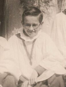
Tony Dexter - choir boy 1951/52/53
|

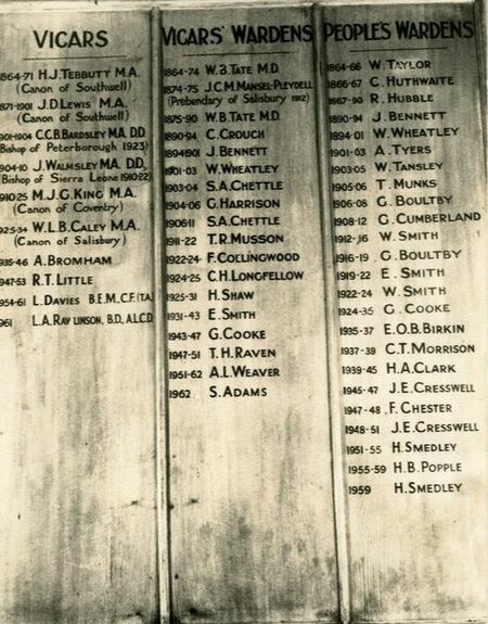
VICARS OF ST ANN'S
|
Nottingham St Ann List of Incumbents
1864-1871 H.J. Tebutt 1871-1900 J.D. Lewis Later Canon St Mary’s, Nottingham 1901-1904 C.W. Bardsley Later Bishop of Peterborough and then Leicester 1905-1909 J. Warmsley Later Bishop of Sierra Leone 1910-? M.J.G. King 1925- ? W.J. Caley An ‘aggressive evangelist’ held street services and Saturday evening evangelist meetings in public houses 1934-1946 A. Bromham War service as a chaplain 1941-1946 1941-1945 R.D. Fryer 1947-1953 R.T. Little 1954-1961 L. Davies Bem 1961-1968 L.A. Rawlinson 1969-1970 P. Swinn Source http://southwellchurches.nottingham.ac.uk/nottingham-st-ann/hincumb.phpsouthwellchurches.nottingham.ac.uk/nottingham-st-ann/hincumb.php |
|
WW1
Stewart John Aldous He was the son of The Reverend John Clement Primrose and Alicia Mary Aldous of St Ann's Vicarage Nottingham. Date of death 25 Mar 1916 Age at death 38 Rank Captain Military Unit 5th Bn Sherwood Foresters (Notts & Derby Regiment) Cemetery Ecoivres Military Cemetery Mont-St. Eloi Remembered on
|

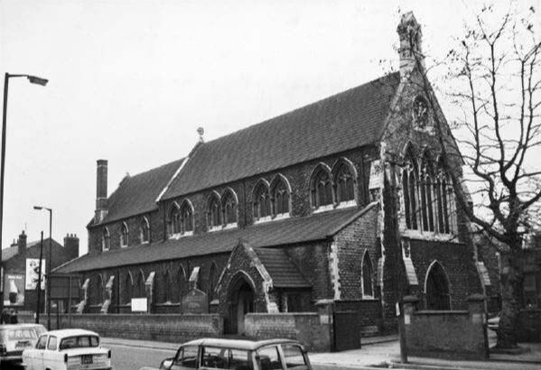
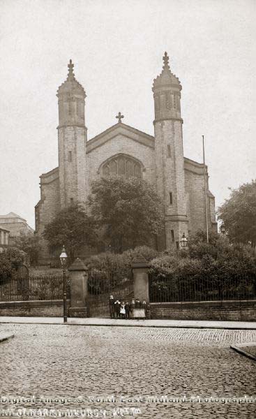
Our Lady and St Edward, Gordon Road
In 1885 the Sisters of St Joseph of Peace established themselves in the Blue Bell Hill area, serving a poor community.
A school was opened, in which mass was also celebrated.
In 1930 a parish was created, and the Franciscans given charge of it. They soon realised that the existing school chapel was not adequate for the growing parish, and by 1937 a large site on Gordon Road was acquired, on which would be built a church, school and Friary.
built 1867
(St Matthias Road, off Carlton Road)
(St Matthias Road, off Carlton Road)
St. Matthias' Church, Nottingham, was a Church of England church in Sneinton, Nottingham, between 1868 and 2003.
It was designed by Thomas Chambers Hine and Robert Evans.
It was consecrated as a chapel of ease in the parish of St. Stephen's Church, Sneinton by The Rt. Revd. John Jackson the Bishop of Lincoln on 6 May 1868.
The chancel was damaged by enemy action during the Second World War.
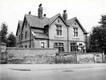
St Mathias Vicarage
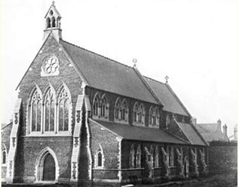
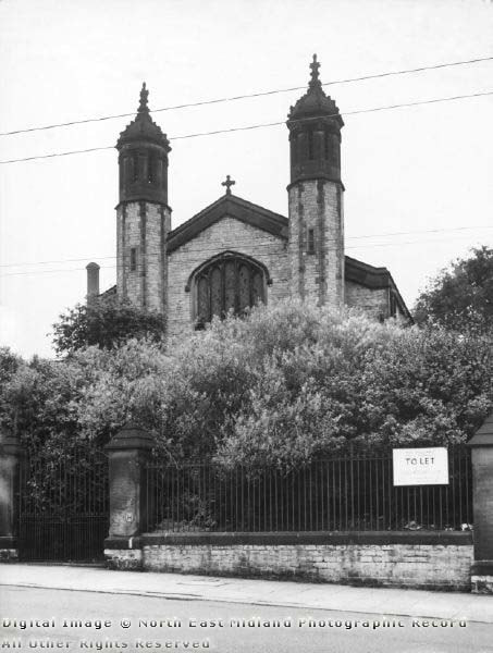
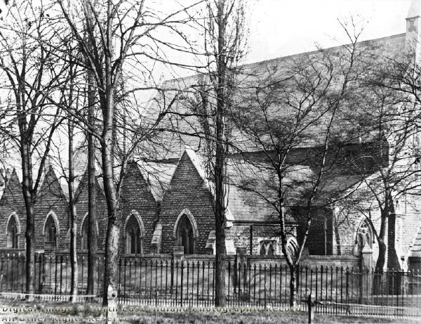
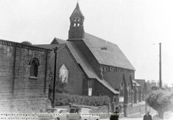
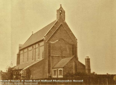
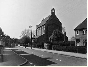
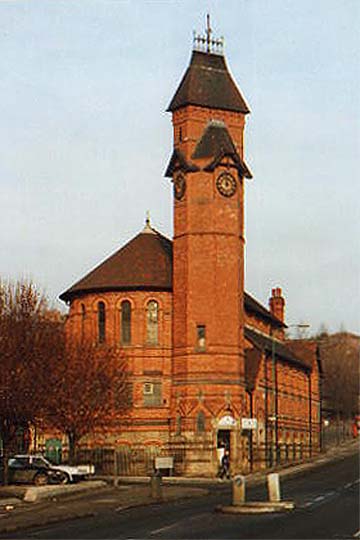
St Bartholomew’s Church, Bluebell Hill, had a comparative short life. A temporary iron church was erected on the site in 1887, and a permanent church opened in 1902. The iron church remained as a church hall.
The church was built on open land, but it soon became surrounded by new housing. The Roll of Honour produced just after the First World War is evidence of the large number of the men in the community who served in the conflict. It contains 704 names, all members of the parish and congregation. In total 136 were recorded as killed.
The church was closed and demolished in 1971 as part of a wider demolition project in the area.
More on this church here: http://southwellchurches.nottingham.ac.uk/nottingham-st-bartholomew/hintro.php
|
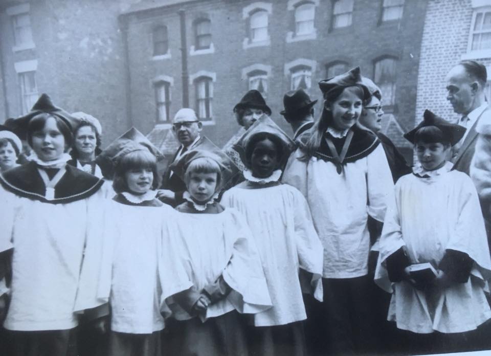
Choir girls of St Bartholomews
|
A comprehensive history of St Catherine's can be found here: http://southwellchurches.nottingham.ac.uk/nottingham-st-catharine/hhistory.php
The site on which St Catherine’s church is located was, until 1834, a green field site on the very edge of the city. Opposite the church site was a small cluster of streets of mainly ‘back to back’ houses. An old pottery occupied land adjacent to the church site.
The building was dedicated by Bishop Christopher Wordsworth of Lincoln on 22 January 1884
|
|
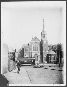
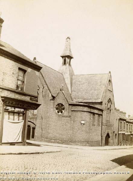
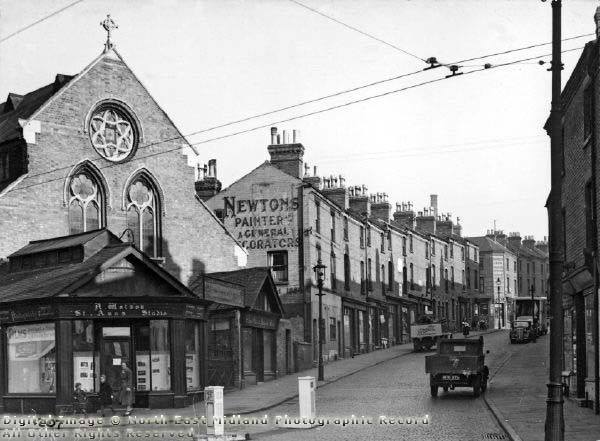
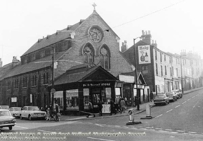
The church was built on the corner of St Ann’s Well Road and Alfred Street in Nottingham. It was designed by architect Richard Charles Sutton and constructed by Mr. Wright of Portland Road. It cost £1,600 and had seating for 500 people. It was opened on 16 March 1870 and was closed in 1970 - subsequently demolished.
|
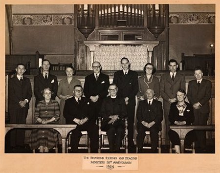
R.K. Ross and the Deacons of St Ann's Well Road Congregational Church
Stanwell Players
The church gained a reputation for its drama group, the Stanwell Players, formed in July 1946. Their first production was Little Ladyship in January 1947. Profits were donated to charitable causes |
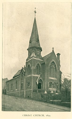
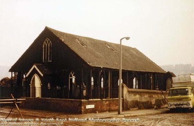
A Sunday School was established from High Pavement Chapel in the St Ann’s Well Rd district in 1860. In 1863 the foundation stone was laid for a new church, on the corner of Peas Hill Road and Raglan Street in St Ann’s. The church opened on 16 June 1864 as a daughter church of High Pavement.
However, the church always struggled with debt, and even as late as 1927, High Pavement Chapel were working to raise money to clear the debt of the church.
Services in the church ceased after February 1932, but the Sunday School continued until 1935. The church has been demolished.
St Mark’s Church was built on a green field site bordering Windsor Street (now Huntingdon Street).
|

|
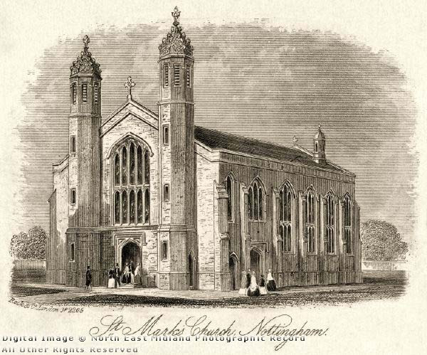
For a comprehensive history of the church - http://southwellchurches.nottingham.ac.uk/nottingham-st-mark/harchlgy.php
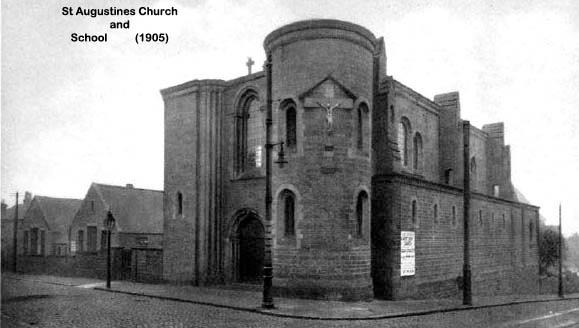
The church was built in 1923. It was designed by John Sidney Brocklesby
St Augustine’s Church was never fully completed (because the estimated price doubled and Brocklesby was sacked) leaving it with a slightly odd appearance with one round tower and one square.
credit http://mapperleyandsherwoodhistorygroup.co.uk/the-history-of-anglican-parishes-in-nottingham

|
|
|
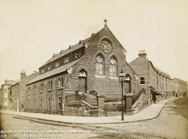
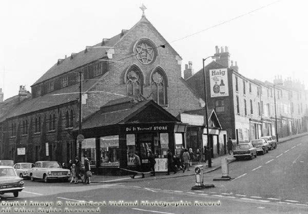
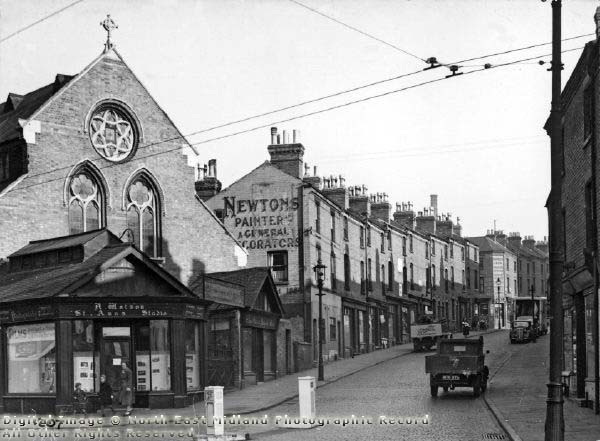
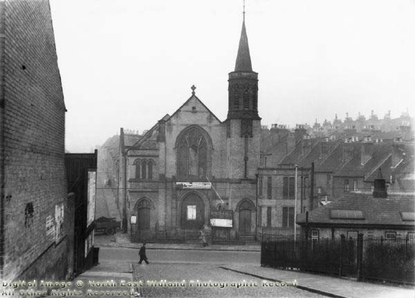
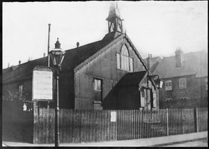
St. Ann's Well Road Wesleyan Chapel (Tin Chapel)1883-1901
On the same site as the open-air meetings had been held, a chapel was built and on 15 February 1883 the foundation stones of the Tin Chapel were laid and it was opened for public worship in May 1883. It was situated at the corner of Martin Street and St. Ann's Well Road and officially known as the "St Ann's Well Road Wesleyan Chapel" although it was affectionately known as the Tin Chapel. At that time, quite a few other places of worship in the district had their original building of the same type as that of St. Ann's Well Road Chapel, but only this one was named "The Tin Chapel". It was built of wood, on a brick foundation, roofed in, and covered with corrugated iron, a steeple or a belfry being on the front. Wooden steps led the way into the outer lobby. The interior comprised one large hall, with a vestry at the rear. The seating accommodation, for 200, consisted of pews down the centre, also at the sides near to the pulpit. Down the sides and front were long reversible forms. The combined pulpit and rostrum was a very fine piece of work. A raised gallery behind the pulpit housed the choir and harmonium. Shortly afterwards, this gallery was removed and the pulpit taken further back. The choir occupied seats on the ground floor just in front of the rostrum. The lighting of the Hall was by gas jets suspended from the roof, each pendant having a ring of about twelve naked lights. To light these jets the caretaker had to use a long pole with a lighted taper at the end. A wooden fence surrounded a pathway, bordered with shrubs and trees, which led around the building. St Anns ...Kings Hall pre 1950 (copied and pasted and edited from http://www.chezfred.org.uk/ Compiled June 2012 Further reading... http://www.chezfred.org.uk/gp/FullAlbertHall/16CHAPTER16.htm |


|
pre-1950 St Ann's Well Road
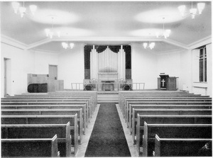
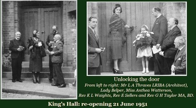
In the mid 19th century open-air meetings were held on a piece of wasteland at the corner of Martin Street and St Ann's Well Road. These were successful, so plans were made to build a Chapel there. Meanwhile prayer meetings were held in a room over a shop near the corner of Livingstone Street, near St Ann's Church and the school. Methodist churches on this site may conveniently be divided into four epochs: 1883-1903 St. Ann's Well Road Wesleyan Chapel (Tin Chapel) 1903-1912 East Nottingham Methodist Church 1912-1941 The King's Hall Mission (to the time of the blitz) 1941-1997 The King's Hall Mission (to the time of closure). Opposite to where the front of the Chapel was to be built was the old Flower Show field. At the side up Martin Street stood some farm sheds, with a "crew" yard where an old farmer called Sheppard brought the cows from the nearby fields to be milked. At the rear of the Chapel was a tract of waste land extending along the tops of the streets on the left of St. Ann's Well Road. These streets were only half the length of what they are today and much narrower as most of the houses had a piece of garden at the front. |

Built 1885
Designed by Watson Fothergill.
Demolished in 1972
One of the vicars, Rev Llewellyn Gwynne, was previously curate at St Andrew’s
and went on to become Bishop of Khartoum and later Bishop of Egypt and Sudan.
|
|
The building was also known as St Ann's Parish Hall and stood near the top of Alfred St North, opposite The Mechanics Arms at the bottom of Vicarage St.
2019 the building still stands - it was occupied for many years by Playworks who organised play sessions for youngsters to bring communities together. Due to lack of funding Playworks went into liquidation 24th April 2019 and has closed down.
image source: https://picturenottingham.co.uk/image-library/image-details/poster/ntgm004956/posterid/ntgm004956.html
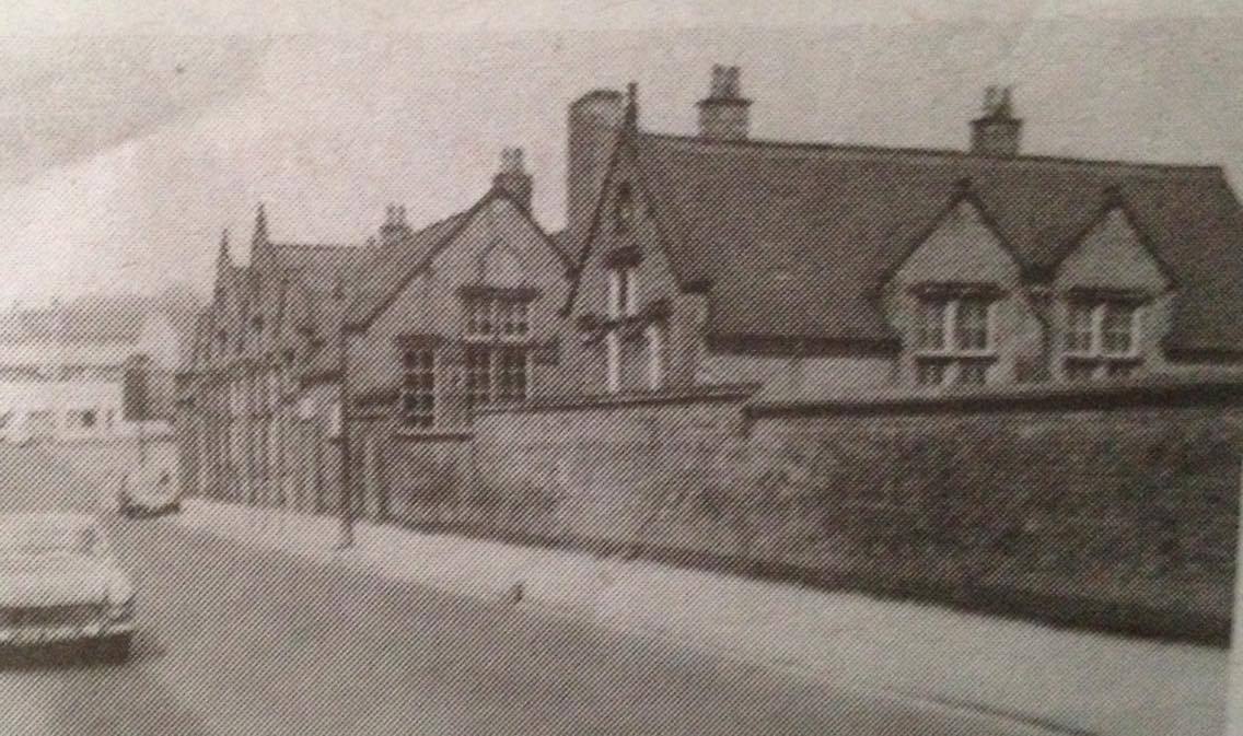
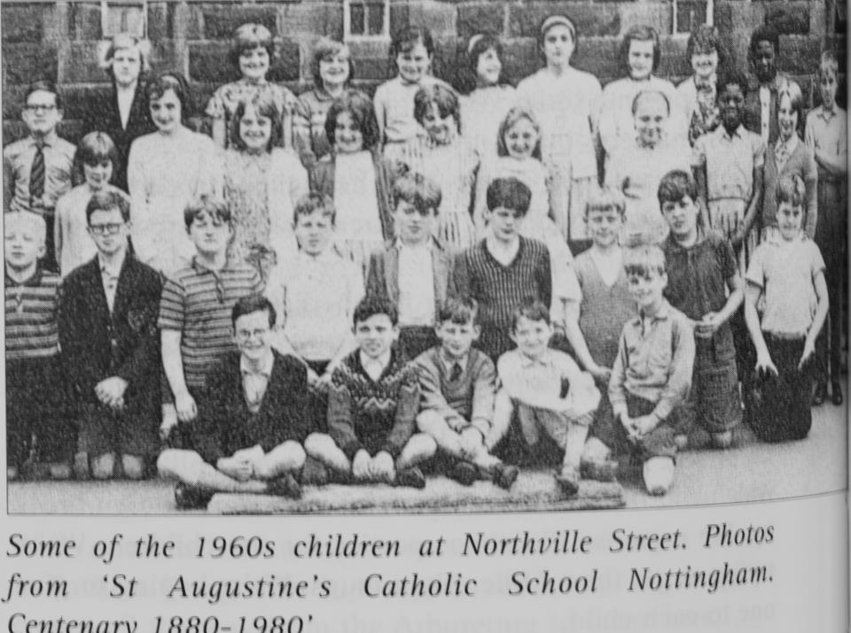
Ged Webster Tony-Ann Miller corner of Alfred st and Banger st typical church school built of stone looking like miniature church ,the teachers that I remember are Miss Blakey Miss Rouse Miss Singleton head mistress. I don't suppose there are any early photos of the classes , I am talking late 40s I have no photos of me before 1954 sad isn’t it
Tony-Ann MillerGroup admin Yes it is Ged, never heard of the school sorry to say....any one else have any further info ? Cheers Tony.
Tony-Ann MillerGroup admin Yes it is Ged, never heard of the school sorry to say....any one else have any further info ? Cheers Tony.
In 1841 Holy Trinity (Trinity Square) was built on land in Burton Leys enclosed in 1839. It cost £10,000. By 1851 Holy Trinity had the largest congregation in Nottingham (1150). The original congregation was drawn from the Charlotte Street area, one of the poorest districts in the town, demolished at the end of the nineteenth century to make way for the Victoria Station. The site of the day schools provided by the church was compulsorily purchased and the money spent on a parish hall in Colville Street. The 177 ft church spire became unsafe after it was damaged by air raids in 1940 and it was removed in 1942. The church closed in 1956 and was demolished in 1958.
(credit: http://mapperleyandsherwoodhistorygroup.co.uk/the-history-of-anglican-parishes-in-nottingham)
|

|
|
Built as a Methodist Church, the foundation stone was laid in 1863 and the building opened on 18 October 1863, named the 'Independent Methodist Church'. In 1870 the chapel was sold to the Catholic Apostolic Church, who remained there until 1951 when it was purchased by the Roman Catholic Church and dedicated on 15 October 1951 for the use of Ukranian Catholics. The building was demolished in 1970.
|
|

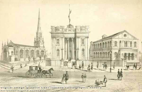
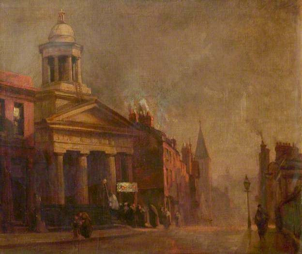
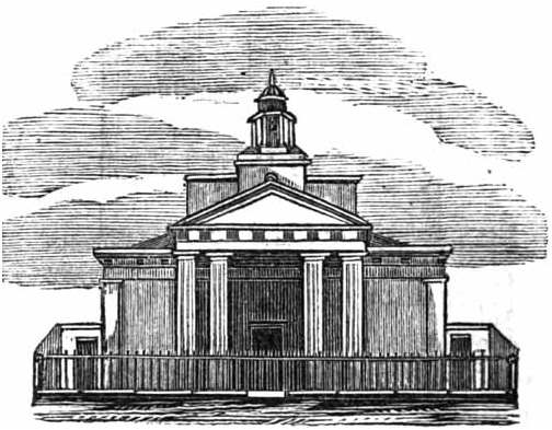
St Paul’s Church, George Street, Nottingham was opened in 1822, the first of several daughter churches of St Mary’s, High Pavement. At that time, the parish of St Mary’s extended over 2700 acres of the town, most of which was open farm land. The two churches were only one third of a mile apart, with St Paul’s serving as a chapel-of-ease to St Mary’s in a district where housing and factory development was taking place. Parish status was conferred in 1839.
The church was designed by William Wilkins in the classical Palladian style to accommodate a congregation of 1,365, but soon after opening the vicar complained about the number of empty pews and by 1851 the congregation had fallen to about 700 (including Sunday Scholars). With seven other Anglican churches and at least ten nonconformist churches and chapels all within less than one mile radius of St Paul’s this was not perhaps surprising.
The church was remodelled in 1894 which reduced the seating to 700. Over the next fifty years, as Nottingham expanded into the surrounding countryside, the number of houses and people living in the parish slowly diminished. Many of the houses were replaced by commercial buildings. Although three of the four George Street church buildings are extant, only one, the Methodist church, continues to serve its original purpose.
In 1924 St Paul’s was closed and it was demolished in 1925.

|


|
|
SLIDESHOW....
|
|


website:
https://stannswellroad.weebly.com
facebook group:
www.facebook.com/groups/StAnnsWellRdPreDemolition1970
https://stannswellroad.weebly.com
facebook group:
www.facebook.com/groups/StAnnsWellRdPreDemolition1970