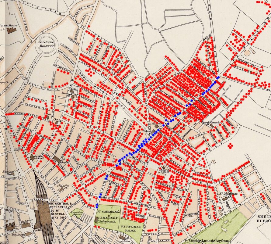
Where on the Map
- The purpose of the image below is to generally indicate where our members lived prior to 1970
- The image is from a portion of a map from the Royal Atlas of England and Wales 1920, consequently some streets developed after 1920 are not shown
- Whilst it does not name ALL streets it gives a clear layout of the roads in close proximity to St Anns Well Rd
More detailed maps can be found here
and the streets here
This map also appears on the members page here
and the streets here
This map also appears on the members page here
* St Anns Well Road residents in blue other members in red
website:
https://stannswellroad.weebly.com
facebook group:
www.facebook.com/groups/StAnnsWellRdPreDemolition1970
https://stannswellroad.weebly.com
facebook group:
www.facebook.com/groups/StAnnsWellRdPreDemolition1970